
Pennine Way
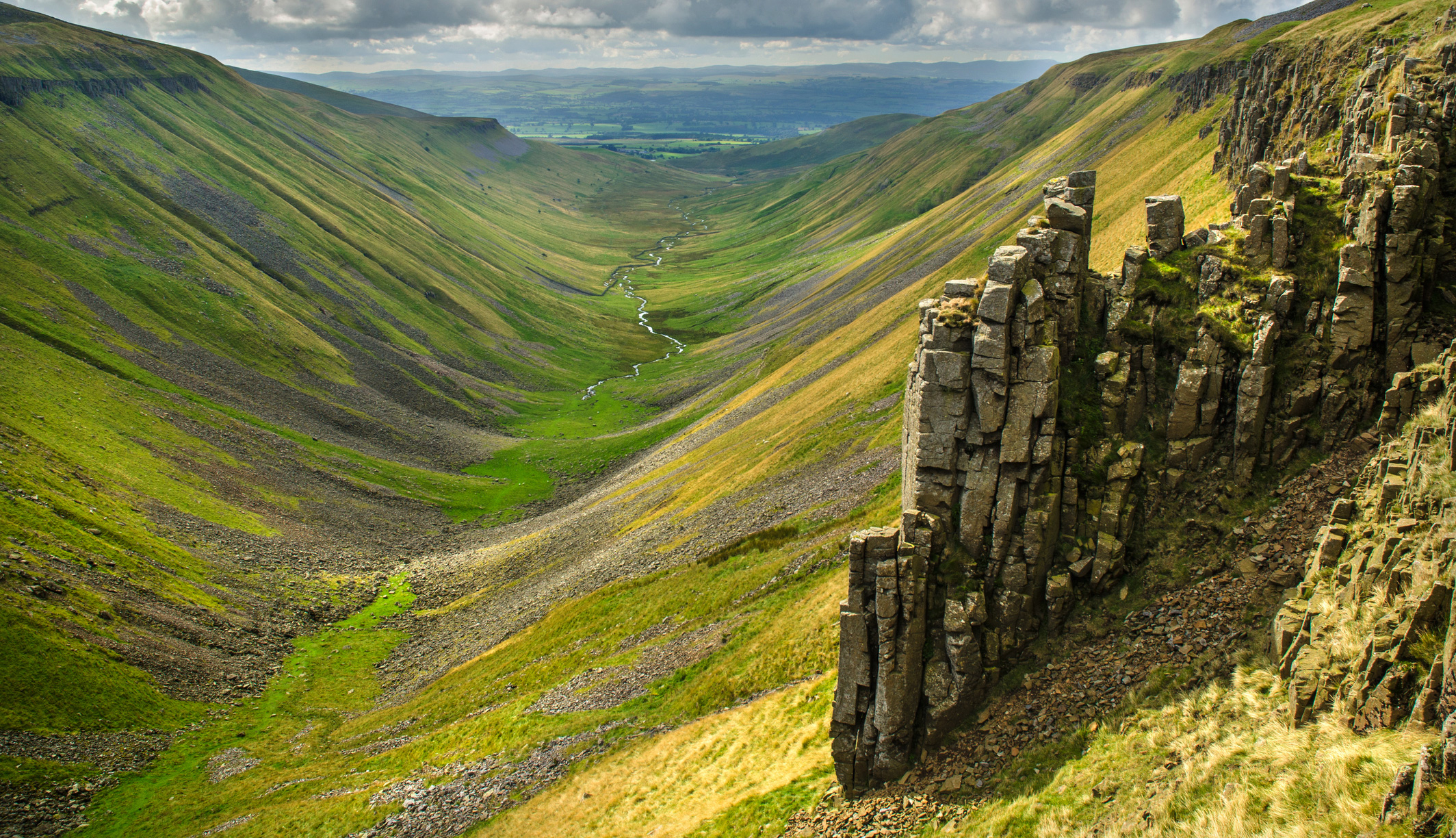
High Cup Nick on the Pennine Way
![]()
Trail Name: The Pennine Way
Location: North England
Distance: 429 km | 268 miles
Duration: 2-3 Weeks
Start/Finish: Edale to Yetholm
Pennine Way Overview
The Pennine Way is located in the North of England. It traverses the length of the Pennine Hills, which are often referred to as the 'Backbone of England'. Walkers can enjoy three of England’s National Parks, an Area of Outstanding Natural Beauty and a National Nature Reserve. Starting out from the north of the Peak District, the Pennine Way proceeds through the South and North Pennines, the Yorkshire Dales, the Northumberland National Park, crossing Hadrian’s Wall on then on over the Cheviot Hills and across the border to Scotland.
In April 1965, the Pennine Way was officially open and was Britain’s first National Trail. Starting in Edale and finishing inside the Scottish border at Kirk Yetholm, the trail is 427km (265 miles) in length. It is a challenging walk that takes around 2-3 weeks to complete with the recommended time of the year being Spring to Autumn.
The nearest international airports to the Pennine Way are Manchester Airport (for Edale) and Edinburgh (for Kirk Yetholm). The towns and villages along the trail are well serviced by public transport, although these become more sparse during Winter months. There is also a good choice in accommodation adjacent to the trail.

Walking the Pennine Way | National Trail from Edale to Kirk Yetholm
The Pennine Way National Trail From Edale to Kirk Yetholm The first official long-distance trail in England, the Pennine Way, has enjoyed new-found popularity in recent years. Its 270 miles (435k..
€18.95 €20.45 Ex Tax: €18.95

Pennine Way | Official National Trail Guide
Pennine Way Official National Trail Guide The Pennine Way was Britain's first National Trail, opened back in 1965. It follows the spine of the Pennine range all the way from the rugged Peak Distri..
€15.99 €17.99 Ex Tax: €15.99

Pennine Way | Edale to Yetholm
Pennine Way Edale to Yetholm The Pennine Way, Britain’s best-known National Trail, winds for 253* miles (407.5 km) over wild moorland and through quiet dales following the backbone of northern Eng..
€16.50 Ex Tax: €16.50

The Pennine Way | The Path, the People, the Journey
The Pennine Way The Path, the People, the Journey The Pennine Way is Britain's oldest and best-known long-distance footpath, stretching for 268 miles between Derbyshire Peak District and the Scott..
€9.70 €12.95 Ex Tax: €9.70

Heart of the Pennine Way
Heart of the Pennine Way The Mid Pennine Way is a 165-mile walk from Hebden Bridge to Hadrian's Wall along the very heart of Britain's premier National Trail. The Mid Pennine Way makes a fine lo..
€11.95 Ex Tax: €11.95

Pennine Way North | National Trail Map | XT40 Map Series
Pennine Way North National Trail Map | XT40 Map Series Pennine Way South map covers the route from Greenhead to Kirk Yetholm. The Pennine Way is a National Trail. It follows the backbone of Eng..
€16.95 Ex Tax: €14.93

Pennine Way South | National Trail Map | XT40 Map Series
Pennine Way South National Trail Map | XT40 Map Series Pennine Way South map covers the route from Edale to Horton in Ribblesdale. The Pennine Way is a National Trail. It follows the backbone o..
€16.95 Ex Tax: €14.93