
Hadrian's Wall Path
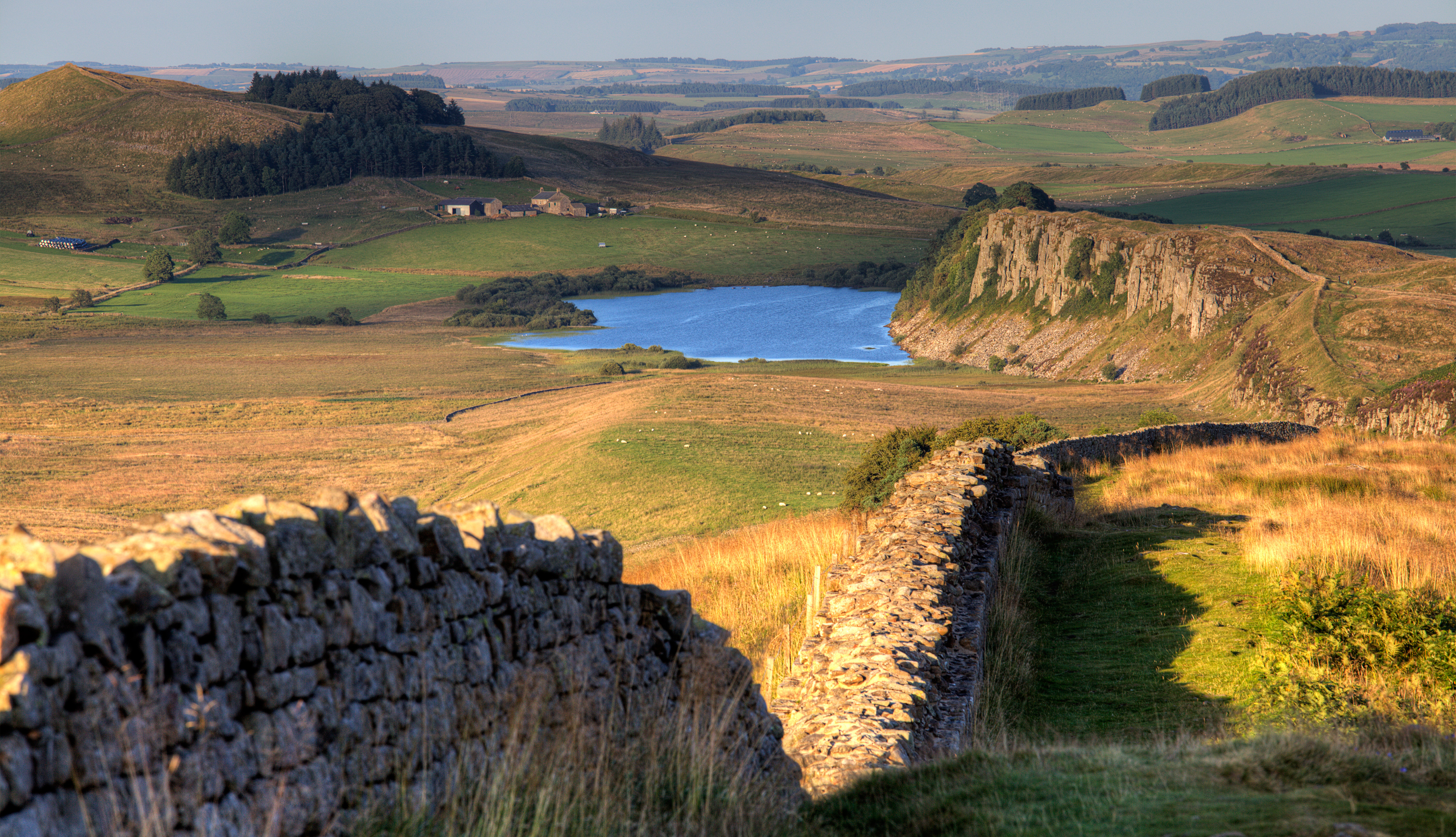
Crag Lough on Hadrian's Wall Path
|
Trail Name: Hadrian's Wall Path
|
Hadrian's Wall Path Overview
Hadrian’s Wall is a UNESCO World Heritage Site that is located in the North of England and spans the width of the country at it’s narrowest point. It is close to the present day border with Scotland. Building work on the Wall began in AD 122, during the reign of the Emperor Hadrian. This was shortly after the Roman Conquest of Britain and Hadrian's Wall acted as a Frontier of the Roman Empire.
Hadrian’s Wall Path is one of England’s most popular National Trails and is a coast to coast trail that links Newcastle-on-Tyne on the North Sea to Bowness-on-Solway on the Irish Sea. The trail is 135km (84 miles) long and is usually walked over the course of one week.
Newcastle and Manchester Airports are the two main International Airports that are closest to Hadrian’s Wall Path. The aptly named AD122 bus route has a frequent service with many stops adjacent to the trail. This service runs between Easter and October each year. Due to the historic status of the trail, walkers are asked not to walk along the trail during the Winter months.

Walking Hadrian's Wall Path | Guidebook and Map Booklet
Walking Hadrian's Wall Path Hadrian's Wall is the finest surviving frontier work from any part of the classical Roman empire, recognised in 1987 as a UNESCO World Heritage Site. Hadrian's Wall Path..
€16.95 Ex Tax: €16.95

Hadrian's Wall Path | Official National Trail Guide
Hadrian's Wall Path Official National Trail Guide Since it opened in 2003 Hadrian's Wall Path has become one of Britain's most popular long-distance paths. Its 84 miles are a convenient week's wal..
€15.99 €17.99 Ex Tax: €15.99

Hadrian's Wall Path
Hadrian's Wall Path This National Trail runs for 86 miles (138 km) between Bowness-on-Solway and Wallsend (Newcastle) along the line of the Roman Wall (AD122). Discover wonderful scenery, vie..
€12.99 €14.99 Ex Tax: €12.99

Hadrian's Wall Path | Wallsend, Newcastle to Bowness-on-Solway
Hadrian's Wall Path Wallsend (Newcastle) to Bowness-on-Solway Hadrian's Wall Path, 84 miles from end to end, follows the course of northern Europe's largest surviving Roman monument, a 2nd-centu..
€13.95 Ex Tax: €13.95

Hadrian's Wall Path | National Trail
Hadrian's Wall Path National Trail Hadrian's Wall Path - this popular long-distance route runs for 86 miles between Bowness-on-Solway on the Cumbrian coast, and Wallsend on Tyneside. It passes thr..
€9.50 Ex Tax: €8.37

Trekking the Hadrian's Wall Path
Trekking the Hadrian's Wall Path Two Way Trekking Guide Hadrian's Wall was one of the Romans' most ambitious structures. When completed, it ran for 73 miles between the west and east coasts of N..
€17.99 Ex Tax: €17.99

Hadrian's Wall Path | National Trail Map | XT40 Map Series
Hadrian's Wall Path National Trail Map | XT40 Map Series Hadrian’s Wall Path is a National Trail and runs 130km (81 miles) from the Solway Coast to Newcastle. The sites of Roman remains are marked..
€16.95 Ex Tax: €14.93

An Archaeological Map of Hadrian's Wall
An Archaeological Map of Hadrian's Wall 1:25,000 Scale Hadrian's Wall is a towering achievement of military engineering and a monument to the power of one of the greatest empires in world histor..
€11.95 Ex Tax: €10.53