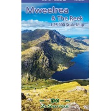
Mweelrea & The Reek
1:25,000 Scale Map | 25Series
Definitive detailed map at 1:25,000 scale covers an area from Mweelrea in the South to Croak Patrick in the North. Produced to our 25Series standard, this general topographic map has a 5 metre contour interval for fine navigation. Signposted walking trails are depicted. Printed on good quality Progeo 90gsm map paper. The map sheet measures 1125mm x 820mm, covering 550 sq kilometres and is folded down to 125mm x 205mm.
Available both in standard folded paper version and folded encapsulated for durability and weatherproofing.
| Map Details | |
| Title | Mweelrea & The Reek Map |
| Map Detail | 1:25,000 |
| Map Series | 25Series |
| Publisher | EastWest Mapping |
| Edition | 1st Edition |
| Release Date | 2024 |
| Finish | Standard / Encapsulated |
| Size | Folded: 20.5cm x 12.5cm x 0.8cm |
| Postal Weight | 115g Standard / 165g Encapsulated |
Mweelrea & The Reek | 1:25,000 Scale Map | 25Series
- Company: EastWest Mapping
- Product Code: EW MWL RK
- Availability: In Stock
-
€14.99
- Ex Tax: €13.21


